Monday, December 17, 2018

December Update


This is always one of the busiest months for our school and classes and finding opportunities to contribute and add to our Parkland Place Based Map has been difficult. We have been organising our equipment, finding and discussing opportunities for the new year to get back out and to continue to collect our images, videos and media.

The weather also makes it hard for the classes to get outside and to be in nature.  Its been cold and rainy over here and so there have been a few cancellations and postponements of activities until some better weather shows up.

We have also taken this time to organise our Google Drive to store and archive footage, images and content from our field trips into Teacher Folders, and then in Dated Folders


This is going to help us a lot later in the year when we need to find images, videos and other media quickly to publish and share to our Google My Maps.

Overall, December has been busy, but we've made lots of behind the scenes progress.

Software, Apps and Extensions with our SETBC Grant

Having the software available to support your goals is essential for a successful project.  Our main software for the project has been to use the following applications and apps:


1) iMovie on our Mac Laptops, which allows us to import our pictures, videos and other content (time-lapse) from our GoPro Cameras onto the laptop for editing and publishing.  We have been using this pretty effectively so far, to create simple videos to publish on youtube, to capturing time-lapse videos and then to speed them up, like this video here:


2) We have also been using the GoPro Apps (Android and Apple) which allows us to pair each GoPro camera to a smartphone and then be able to view live images through the gopro camera on our phones, which means we can check and see how things look!  It also allows us to share and extract videos, images and content without having to hook the GoPro cameras up to our laptops, saving some time and a few extra steps:


3) Finally, we have been using Google My Maps (mymaps.google.com) to collect and connect all of our content, videos, images, descriptions, locations, annotations, layers, and distance markers onto our shared, collaborative map:


Thursday, November 15, 2018

November Project Update


November Explorations in Map Making!


This month, our project team has been working hard on getting our project setup and to start working with a few of our classes, teaching them about the equipment, our goals, and the final format for our map.

We have been working on teaching them how to use our GoPro Cameras, how to store and archive any footage/images they have collected and introduced the students to our final Map, so they are aware of the final goals and product of our project.


We have had two classes go out and explore our Saanich Peninsula so far, one class went to Goldstream Provincial Park to learn more about the Salmon cycle and the local environment at Goldstream.


We've also had a different class go to a local beach near our school to do a Beach Clean up day and they also used the opportunity to catch a few good pics and videos of our local marine environment.


And here is our ongoing Map with our SD 63 zones and schools added onto the map already.


Thursday, November 8, 2018

Digital Citizenship in our Map building at Parkland

Parkland Place Based Map Synergy Project.

At Parkland, we are working on developing a collaborative, many layered digital Google Map that captures, organises and shares many different views and perspectives on our Saanich Peninsula. 

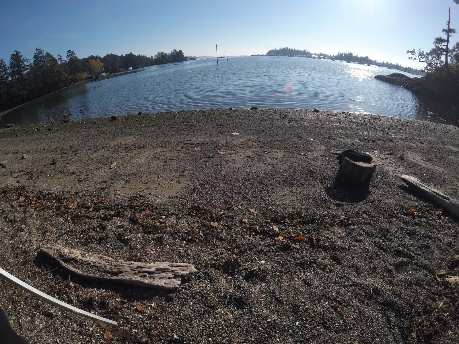
We have begun working with many classes from many different subject areas to go out and capture video, images, interviews, and content from their explorations to our unique and special spots around our region.

We hope to create many different "layers" on the map, from simple demographic layers, layers of all the SD63 Schools, as well as "Biology", "Geography", "First Nations" and "Marine Science" layers that capture the different interesting spots, discoveries and highlights from around our region.  These spots will be captured through photos, videos, 360 degree photo-spheres and interviews.

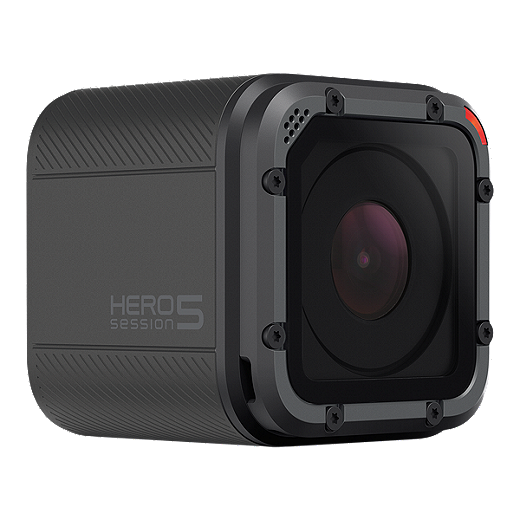
Digital Citizenship is an important part of this map building process and we have begun talking with our classes and students about appropriate usage with our GoPro Cameras, and capturing only images and video of students who are 1) comfortable being captured, and 2) have a signed release form on file.

We also have all SD63 students sign a G-Suite Permission form that explains what personal information is used on their SD63 Google accounts, and that they need to be informed about what is captured, what is not, and how it will be used.  We regularly review the personal information used in our systems and the addition of the SETBC required permission forms is similar to our existing SD63 practices.  We are working on capturing permission forms for any student that is apart of our project in a personal and identifiable way.

Overall, digital citizenship is about more than just protecting personal information.  Digital Citizenship can be simplified to just 'citizenship' in that we want our students to be respectful of each other, as well as respectful of each other's digital presence, online activities and opportunities to choose whether they are visible and identifiable participants in our community events.  We need to respect all viewpoints and provide alternatives for students who are not comfortable in front of the camera, or having their personal information shared online by others.  We need to practice good citizenship with each other all the time, whether digital or not.  This project is allowing us to explore these concepts with students, and provide real world learning opportunities that reflect what they might be building or creating on their own in their communities and families.

We would also like to acknowledge that we have the privilege of working and living on the traditional territory of the W̱SÁNEĆ people. As part of our project, we aim to connect with local elders and knowledge keepers in partnership to respectfully include traditionally significant geographical locations. We will be connecting with members of the 4 nations that reside on the Saanich Peninsula: TSAWOUT, TSARTLIP, PAUQUACHIN, and TSEYCUM.  We will be following the Saanich School District 63 protocol to ensure that all necessary steps are taken in this project when representing local knowledge from community members. It is important to us that the stories and information that is presented on our map is both factual and respectful.


Tuesday, October 23, 2018

Our Early Map

Here is our very early map, just starting to explore features and adding layers.


Our humble Beginnings! Laptops and GoPros


Image result for apple mac pro laptop mid 2012

Slow steady steps forward!

We are just starting to get our feet underneath us for our project and have had to be nimble and responsive.  It took us about 7 weeks to get our equipment finally (8 Macbook Pro Laptops - Mid 2012) 2 GoPro 5 Cameras and many accessories and adapters.

Image result for gopro 5

Image result for gopro 5 session

We are just starting to set up our laptops and are hoping to get some video editing software going and begin to teach our students about capturing good content.  We are excited for our next steps and have a goal of trying to capture some images, videos and interviews to start practicing our new map skills.

Monday, September 24, 2018

Welcome to Parkland's Place Based Map Making Blog!

Aaron Mueller - Teacher-LibrarianShannon Crawford - Teacher / Indigenous Ed SupportErin Stinson - Geography Teacher - IST
Hello!

Erin, Aaron and Shannon are teachers at Parkland Secondary focused on helping our students learn new skills, explore new tools and build a collaborative map of our Saanich Peninsula that highlights and documents geographic features and important W̱SÁNEĆ locations, spaces and localized first nations knowledge.


We are working with many Outdoor Education and Geography classes, first nations students and community members to help build our map together over the years ahead.  We are excited about making this a ‘living project’.